5 min read
15 Best Custer State Park Hiking Trails (Short & Scenic!)
Explore the top 15 Custer State Park hiking trails for breathtaking views & wildlife. Perfect for travelers seeking scenic, short hikes in South Dakota.

Custer State Park is an iconic 71,000 acres of spectacular natural brilliance. From world-class scenic drives to its abundant wildlife population, Custer State Park is widely regarded as the greatest State Park in the United States.
Just a stone’s throw from the presidential Mount Rushmore, Custer State Park rests in the heart of the Black Hills Mountains in rural South Dakota. The park is host to nearly 1,300 bison, as well as massive herds of elk, mountain goats, pronghorn antelope, and a band of friendly burros. Enhance your adventure to the Black Hills with a unique Dakotan safari, exploring this dense and distinctive habitat.
In these hills are unique geology and striking terrain perfect for hiking. With overlooking mountain views and breathtaking lakes, Custer State Park has miles of hiking trails that are unparalleled in any regard.
Here is your guide to the 15 best hiking trails in Custer State Park.
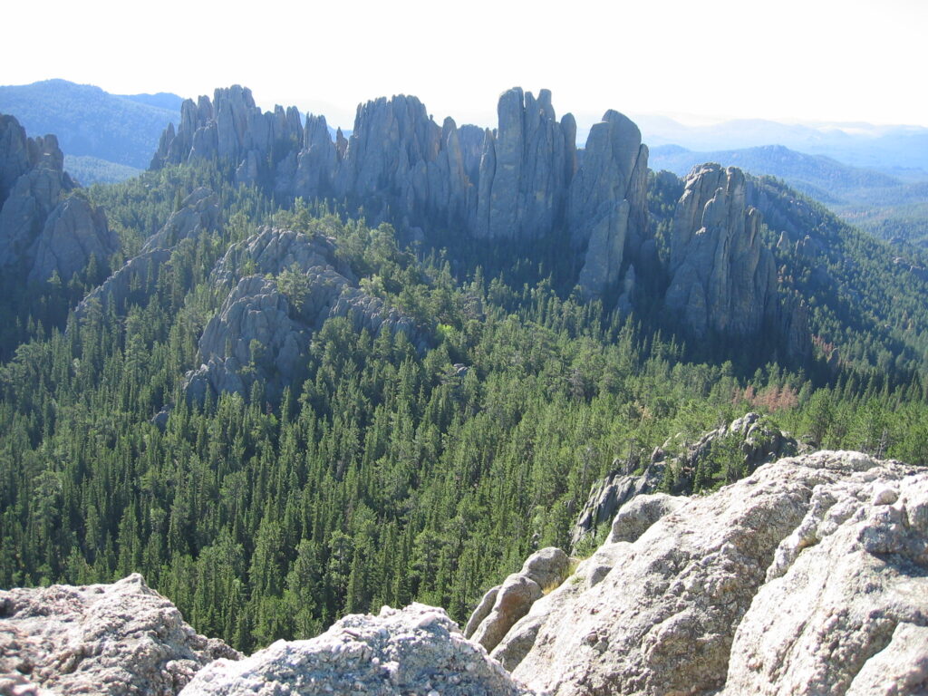
1. Black Elk Peak Loop: South Dakota Highpoint Trail

Credit: Randall R / Flickr
Directions: From Custer, head east on US-16A E and drive for 0.7 miles. Turn left onto SD-89 N and drive for 6.0 miles. Turn right onto SD-87 S and drive for 0.3 miles, then turn left. After 0.2 miles, the parking area will be on your left.
The Black Elk Peak Loop via the South Dakota Highpoint Trail is an iconic journey to the peak of South Dakota’s greatest mountain. At a towering 7,242 feet above sea level, the summit of Black Elk Mountain is not only the tallest mountain in South Dakota but is also the highest point east of the Rocky Mountains.
Beginning at Sylvan Lake, the journey to the peak is at times arduous but is a memory that will last a lifetime. The hike is a long and gradual climb along a dirt path with minimal roots until the path transforms into a much more challenging surface. The trail will become increasingly rockier before ascending rock scrambles to the summit.
Once reaching the peak, climb to the top of the Stone Fire Tower, a 360-degree lookout from the highest point in this great state.
Difficulty: Moderate
Distance: 7.1 Miles
Elevation Gain: 1,469 Feet
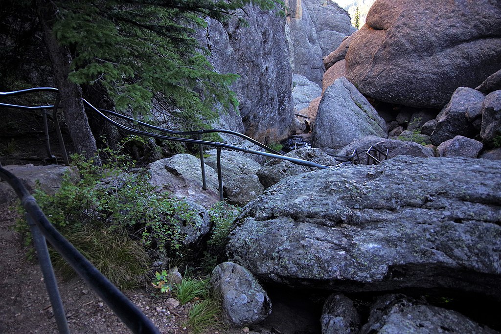
2. Cathedral Spires Trail
Credit: Johnida Dockens / Flickr
Directions: From Custer, head east on US-16A E and drive for 0.7 miles. Turn left onto SD-89 N and drive for 6.0 miles, then turn right onto SD-87 S. Continue for 2.4 miles and the parking area will be on your left.
The Cathedral Spires Trail is a stunning spur trail surrounded by outstanding geological features. Rock formations made of picturesque granite, emerge from the surface in the most unique way.
The trail is well-marked and easy to follow. As you make your way up the hill, the hiking grades will only become more difficult. The final third of the trail is a set of knee-buckling switchbacks before reaching a scenic meadow beneath the spires.
Thanks to the abundance of unique geology, several established climbing trails weave between the otherworldly spires. It is quite common for rock climbers to suspend above you in the halls of the cathedral.
Difficulty: Moderate
Distance: 1.6 Miles
Elevation Gain: 488 Feet
Related Read: Best Time to Visit Mount Rushmore
3. Sunday Gulch Trail
Directions: From Custer, head east on US-16A E and drive for 0.7 miles. Turn left onto SD-89 N and drive for 6.0 miles. Turn right onto SD-87 S and drive for 0.3 miles, then turn left. After 0.2 miles, the parking area will be on your left.
The Sunday Gulch Trail is a difficult trek, but the effort is far worth the reward. This secluded trail is less traveled than some of the other scenic hikes in the park. With seemingly endless lookouts, the trail provides incredible views that will easily distract you from the strenuous task in front of you.
Beginning at Sylvan Lake, the trail abruptly ascends over slick boulders. With the help of attached handrails, you will continue to climb higher – earning greater and greater overlooking views of Sylvan Lake and its diverse granite formations.
Luckily, the elevation gain is only in the beginning as the remainder of the trek travels along the ridge, overlooking the gorgeous park.
Difficulty: Strenuous
Distance: 3.9 Miles
Elevation Gain: 797 Feet
4. Little Devil's Tower Spur Trail

Directions: From Custer, head east on US-16A E and drive for 0.7 miles. Turn left onto SD-89 N and drive for 6.0 miles. Turn right onto SD-87 S and drive for 0.3 miles, then turn left. After 0.2 miles, the parking area will be on your left.
The Little Devil’s Tower Spur Trail is a moderate-to-difficult hike to the summit of an unmatched overlook in Custer State Park. Depending on the time of year, this trail is the premier place to see blooming wildflowers.
Unlike most trails, this hike is not along a dirt pathway, but of quartz boulders. This trail looks down upon the dense forestlands of aspen and spruce trees. The trail does become steeper the higher you ascend.
As you approach the peak, you will happily endure a back-breaking set of switchbacks until you reach the summit. From the summit, enjoy 360-degree views of Custer’s best features – including the Cathedral Spires and Black Elk Peak.
Difficulty: Moderate
Distance: 3.6 Miles
Elevation Gain: 751 Feet
Related Read: Mount Rushmore to Yellowstone Road Trip
5. Lovers' Leap Trail

Credit: Tony Kielbasa / Flickr
Directions: From Custer, head east on US-16A E/Custer Street and drive for 13.3 miles, then the parking area for this hike will be on your right.
The Lover’s Leap Trail is a beautiful hike along a scenic ridge, overlooking the State Game Lodge and the surrounding valley. This hike leads through a dense ponderosa pine forest with clear views of the wildlife abundant fields below.
At any given time, you may see large herds of elk, bighorn sheep, and bison – sometimes all at once! The trail leads to the majestic outcropping.
Lover’s Leap is named after a Native American legend in which two lovers jumped together from this very point. Like the legend, the overlooking view is romantic and dramatic.
On a cloudless day, the outcropping has views of Mount Coolidge, Harney Peak, and the Cathedral Spires. The trail will descend until reaching the Coolidge General Store and you will follow the road back to the parking area.
Difficulty: Moderate
Distance: 4.2 Miles
Elevation Gain: 626 Feet
6. Sylvan Lake Shore Trail

Credit: Gail K E / Flickr
Directions: From Custer, head east on US-16A E and drive for 0.7 miles. Turn left onto SD-89 N and drive for 6.0 miles. Turn right onto SD-87 S and drive for 0.3 miles, then turn left. After 0.2 miles, the parking area will be on your left.
The Sylvan Lake Trail is a calm journey around the shores of these reflective waters, surrounded by unique geological wonders. The most recognizable lake in all the Black Hills, Sylvan Lake is a photographer’s or filmmaker’s dream.
The picturesque shores are a popular place for landscape photography, as well as a highly sought-after location for weddings. Sylvan Lake could be the most stunning swimming hole you may find.
The loop follows the shores of the lake, hopping over the unique geology that makes Custer State Park an absolute treasure.
Difficulty: Easy
Distance: 1.1 Miles
Elevation Gain: 82 Feet
7. Prairie Trail

Directions: From Custer, head east on US-16A/Custer Street and drive for 6.6 miles, followed by an immediate right toward SD-87 S. Continue for 5.6 miles and turn left onto Wildlife Loop Road. After 5.4 miles, the parking area will be on your right.
The Prairie Trail is a wonderful opportunity to witness some of Custer State Park’s famous wildlife populations. The abundance of native grasslands and other plants makes this path an ideal habitat for pronghorn antelope, deer, and bison.
In addition to the beautiful wildlife, this section of the southern prairie is home to some of the best summer wildflower displays in the region.
The trail will ascend the hills and traverse the scenic ridge. From this unique vantage point, you will have spectacular panoramic views of all the elements of this active prairie. The ending portion of the trail follows a small stream through the lush woodlands.
Difficulty: Easy
Distance: 2.1 Miles
Elevation Gain: 423 Feet
Related Read: 25 Best & Fun Things To Do in Spearfish, SD
8. Legion Lake Loop

Credit: BEVERLY WICKERSHAM / Flickr
Directions: From Custer, head east on US-16A E/Custer Street and drive for 7.4 miles, then the parking area for this hike will be on your right.
The Legion Lake Loop is an easy hike around a calm lake and is conveniently just off the highway. The easy stroll around the lake is a flat dirt surface that hugs the shores of Legion Lake.
Thanks to the comfortable trail conditions, this hike is perfect for hikers of all skill levels or individuals limited for time.
This trail is also an excellent place to view the park’s wildlife. It is common for the massive bison to stop by this lake for a drink.
Difficulty: Easy
Distance: 0.7 Miles
Elevation Gain: 39 Feet
9. Custer State Park Wildlife Scenic Byway

Credit: David Hewett / Flickr
Directions: From Custer, head east on US-16A E/Custer Street and drive for 14.1 miles. Make a slight right onto Wildlife Loop Road and the parking area for this hike will be on your right.
The Custer State Park Wildlife Scenic Byway is a long, but memorable journey that travels through diverse sections of the southern part of the park.
Essentially this trail follows along the paved byway, however, there is enough distance from the road on the grassy shoulder that the path still feels like a journey in the wilderness.
The highlight of this trail is the sheer amount of wildlife viewing opportunities. Of the 1,300 bison, the majority of the herd are found in the southern section. In addition, you will likely see bighorn sheep, pronghorn, elk, and prairie dogs.
The most unique part of this trek is the Blue Bell Stables and their wild burros. These burros have been accustomed to passing travelers feeding them and are aggressively friendly.
Never feed the wildlife – you may think you are helping, but it only hurts their ability to survive without human intervention.
Difficulty: Easy
Distance: 18.0 Miles
Elevation Gain: 2,043 Feet
Related Read: 21 Best Romantic Midwest Getaways
10. The Lost Trails: Lower Loop

Directions: From Custer, head east on US-16A E and drive for 8.0 miles. Turn left onto SD-87 N and drive for 2.9 miles. Turn right onto S Playhouse Road and continue for 0.7 miles, then turn right onto Center Lake Road. After 0.6 miles, the parking area will be on your left.
The Lost Trail is a series of hiking trails that travel through the beautiful hillside surrounding Center Lake. The Lower Loop Trail is a wonderfully secluded hike around the shores of Center Lake.
The trail is made of packed dirt with a moderate amount of roots emerging from the surface. The route wanders through dense woodlands with minor climbs to the short cliffs above the water.
If you would like scenic views of the entire lake, look for the signs for the short lookout point trail marker. It adds about a mile but offers panoramic views of the entire Lost Trail area.
Difficulty: Moderate
Distance: 1.6 Miles
Elevation Gain: 252 Feet
11. Badger Clark Historic Trail

Credit: Kevin Stewart / Flickr
Directions: From Custer, head east on US-16A E/Custer Street and drive for 7.4 miles and turn right. Make an immediate right onto Badger Hole and after 0.2 miles, the parking area will be on your right.
The Badger Clark Historic Trail is a walk into the past through the eyes of the famous writer and poet. Badger Clark discovered this entrancing section of what would become Custer State Park.
He moved into the cabin in 1925 and would live there, uninterrupted, for another 30 years. Much of his inspiration was drawn from the spectacular natural beauty of this area.
Today, the trail that takes you to the cabin was created by Badger himself. During the summers, volunteer rangers offer tours and exhibits of Badger’s extraordinary home.
Difficulty: Easy
Distance: 0.6 Miles
Elevation Gain: 134 Feet
12. Grace Coolidge Creekside Trail

Directions: From Custer, head east on US-16A E/Custer Street for 14.0 miles and turn right onto Game Lodge Campground Road. Drive for 0.2 miles and turn right. After another 0.2 miles, the parking area will be on your right.
The Grace Coolidge Creekside Trail is a pleasant hike that rolls through beautiful sections of southeast Custer State Park. This peaceful trail, named after our 30th first lady, is a comfortable journey across a gentle plateau.
The paved pathway leads past the State Game Lodge, the Peter Norbeck Visitor Center, and the Coolidge General Store.
It's common that herds of bighorn sheep and bison gather around for the sunset. Take the opportunity to relax and have a gander!
Difficulty: Easy
Distance: 3.9 Miles
Elevation Gain: 213 Feet
13. The Lost Trails: Upper Loop and Overlook

Directions: From Custer, head east on US-16A E and drive for 8.0 miles. Turn left onto SD-87 N and drive for 2.9 miles. Turn right onto S Playhouse Road and continue for 0.7 miles, then turn right onto Center Lake Road. After 0.6 miles, the parking area will be on your left.
The Outer Loop of the Lost Trail is a tranquil but challenging journey with memorable overlooking views. This section of the Lost Trail begins on a peaceful ridge and is seldom traveled.
The hike ascends quickly and will certainly get your heart racing. The trail wanders into a dense forest that loops around the impressive ridge in the Black Hills, with expansive views in all directions.
The highlight of the hike is on the steep edge of the granite bluffs, overlooking the entirety of Center Lake and the lush woodlands that surround it.
Difficulty: Moderate
Distance: 1.1 Miles
Elevation Gain: 249 Feet
14. French Creek Trail

Directions: From Custer, head east on US-16A E/Custer Street and drive for 14.1 miles. Make a slight right onto Wildlife Loop Road and continue for 3.8 miles. Make a right and after 0.3 miles, the parking area will be on your right.
The French Creek Trail is an interesting journey that travels through the heart of the park. This trail is not even an established path. No type of signage or markers will be available, so be cautious.
French Creek runs east-to-west through Custer State Park and to follow the trail, you simply follow the creek. There is a vague trail that has been established by the feet of previous hikers.
This hike is a relative unknown and can almost guarantee privacy as you wander through some of the most impressive sections of the park. Just be careful not to sneak up on wildlife – a startled bison is a dangerous bison.
Difficulty: Moderate
Distance: 12.8 Miles
Elevation Gain: 1,387 Feet
15. Legion Lake Campground Trail

Credit: Ken Lane / Flickr
Directions: From Custer, head east on US-16A E/Custer Street and drive for 7.3 miles, then turn left into the parking area for this hike.
From the shores of Legion Lake, the Legion Lake Campground Trail climbs high above the lake on a beautiful overlooking ridge.
This short-but-steep journey around the lake is a peaceful, but an arduous trek through the dense woodlands surrounding the picturesque lake.
There are a lack of viewpoints on this hike. The trail is an exclusive opportunity to experience Custer State Park and find peace in the glory of nature.
Difficulty: ModerateDistance: 1.0 MilesElevation Gain: 337 Feet


![Ultimate Guide: Best Places to Live in Delaware for Everyone [2024]](https://assets-global.website-files.com/658352c9dc46a8af3404d0e2/66118281565af45f6b1b30b7_NHIOz7nu3T62vmrZOi-FIX00BZTklY2LQhle4Q9mXBg.webp)


